Latest news https://www.kelstongirls.school.nz/Events-News/Latest-News-1
ENROLMENT SCHOOL ZONE
Kelston Girls' College School Zone
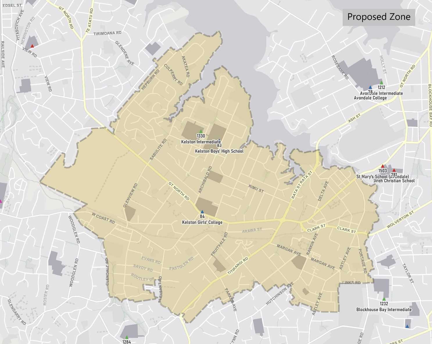
The home zone area is shown on the mapbelow and includes:
Starting at intersection of Great North Road and Hepburn Road, travel north on Hepburn Road (included) and continue in a straight line along the southeastern edge of Hepburn Park to the coastline. Travel initially east and then follow the coastline all the way until where the Whau River becomes the Avondale Stream, and continue along the Avondale Stream until Wolverton Street. Travel west along Wolverton Street before turning south at Portage Road (included up to 74 even and 107 odd addresses). Turn west at Links Road (included) and then turn south along the western edge of Titirangi Golf Course until Akehurst Avenue. Travel west along Akehurst Avenue (even addresses included) and then north along Astley Ave (93 and below odd, 120 and below even included). Turn west at Gardner Avenue (included) and then southwest along Seabrook Avenue (91 and below odd, 58 and below even addresses included), continuing as it becomes West Lynn Road (excluded). Then turn north at Titirangi Road (240 and below even, 223 and below odd included) and then west at Pleasant Road (94 and below even, 31 and below odd included). Turn west at Routley Drive (included) and then south at Captain Scott Road (67 and below odd, 72 and below even included no exit roads Terra Nova Street and north of Terra Nova Street also included). Travel west along the northern edge of Ceramco Park until Glendale Road, turning north along Glendale Road (even addresses 110 and below, odd addresses 29 and below included) until West Coast Road. Turn west along West Coast Road (340 and below even, 297 and below odd included), and then travel north along the western edge of Waikumete Cemetery back to the origin of the zone.


 Admin Login